June 14, 2021
Panorama Trail, Yosemite National Park
Total distance walked: 11.58 miles
When, I wondered, will I ever hike the Panorama Trail? It’s been on my to-do list for a decade. When the Day Use Permits went on sale in April, my niece contacted me. She wanted to hike it. I was excited, to say the least. We both obtained permits, then drove separately into Yosemite. I parked near Happy Isles, the trail’s end—elevation 4,000 feet. From there we drove together in her car up to Glacier Point, where the trail begins—elevation 7,214 feet.

The Panorama Trail is famous for its bird’s-eye view of the east side of Yosemite Valley and its stunning geologic features.

From the trailhead we walked on a cliffside path overlooking Half Dome, Nevada Fall and Vernal Fall. As we stood well-above the waterfalls, their thunderous sound was soothing. Later we would be down by both of them.

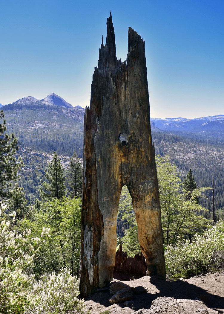
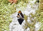
Down, down, down we went on the east slope of Illilouette Ridge. A potential sign of California’s drought were the many dry stream beds we crossed, but there were a couple of wet ones too. There, in the dampness, butterflies fluttered from flower to flower.

A family sat at the overlook gazing at Illilouette Fall. So as not to disturb them, we didn’t get a good look. Instead, we continued downward into the gorge.
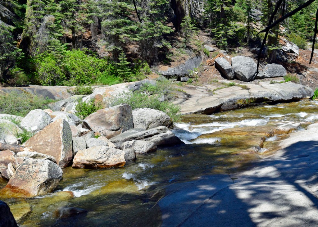
We followed Illilouette Creek that ran lazily underneath the footbridge. Before the bridge, there was a warning sign alerting hikers to the presence of an elusive waterfall.


Nearby, it was a joy to see bright red snowplants growing in the deep decaying soil.

Upon crossing the bridge, we began an uphill slog zigzagging the forested hillside. The trail skirted the edge of Panorama Cliff overlooking Yosemite Valley. It was a good change of pace to walk uphill and give our knees a break.
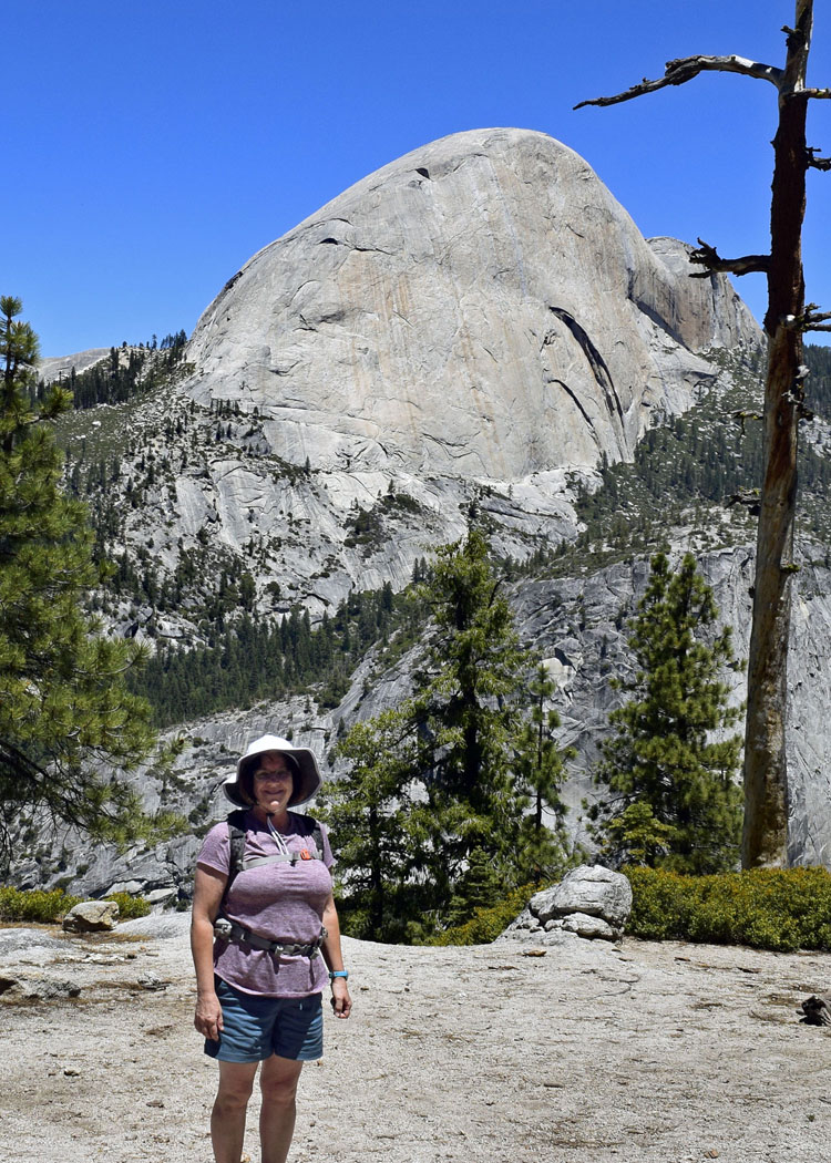
Peeking between the trees as we rounded the switchbacks was Half Dome. Seeing this Yosemite icon from a different angle was thrilling.

Once the trail leveled, we stopped for lunch with a commanding view of Half Dome. A gusty breeze funneled through the gorge cooling our weary bodies.
Rested, rehydrated, and ready to go, we hopped back on the trail.

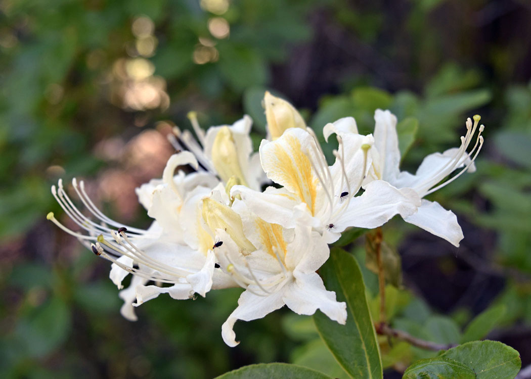
The downward trek took us toward Nevada Fall through an aromatic garden of wild azaleas. Their captivating fragrance made me want to stand there forever.
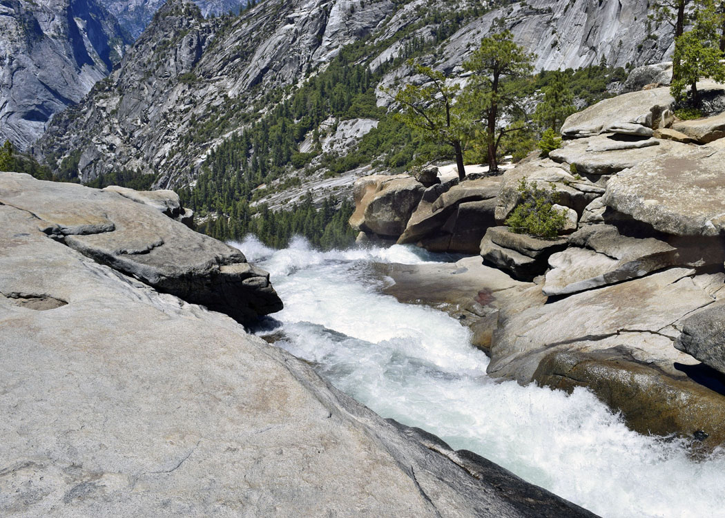
From this point on we encountered many hikers. An extra jaunt (one mile roundtrip) took us atop the bridge at the brink of Nevada Fall. Water plummeted over the sheer rock cliff. Later we would see the entire waterfall.

The Park encourages people to take the longer route back via the John Muir Trail from Nevada Fall instead of the shorter Mist Trail. We were okay with that since neither of us wanted to walk down the slick rock stairs of the Mist Trail after having walked nine miles. However, I wasn’t prepared for the knee-jarring pain from the continual steep downhill trek.

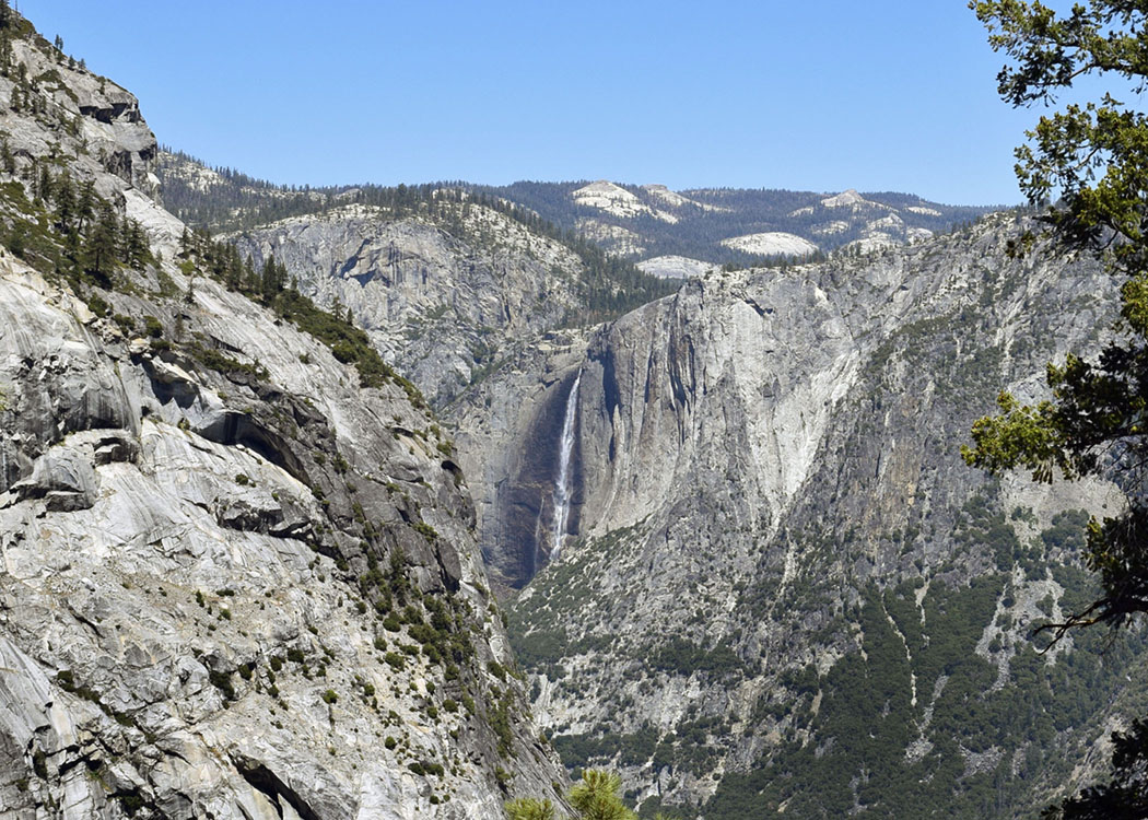
The next section of trail was cut into the side of a cliff. From there it offered a wonderful view of Nevada Fall and the grayish, dome-shaped Liberty Cap. Nevada Fall is my favorite waterfall in Yosemite.

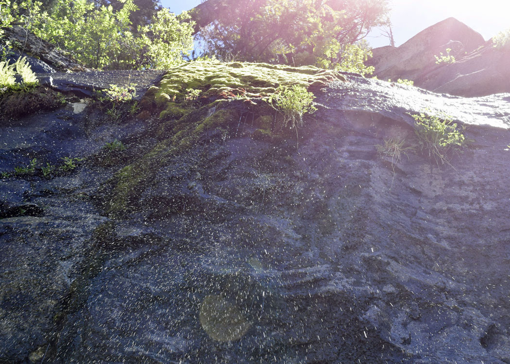
An overhanging rock above the trail dripped water on us and made the rocky terrain even harder to navigate.
None too soon we arrived at the Vernal Fall footbridge where we stopped for a much-needed break.

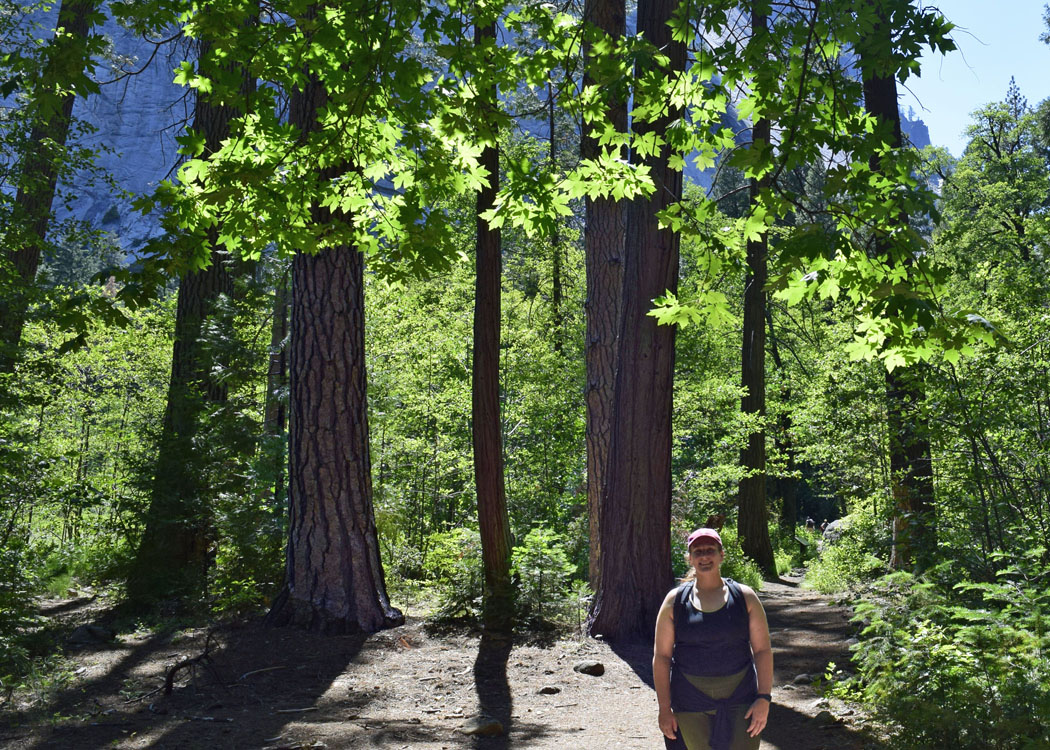
With sore knees, we crossed the bridge and continued hobbling down a steep asphalt path crowded with hikers to Happy Isles. A mile past Happy Isles, we reached my car.
Even though my knees were screaming from descending 3,214 feet, the hike was well-worth it. The thundering waterfalls soothed us; the breeze cooled us; the air filled with diverse birdsong was music to walk by; and the different aromas and wildflowers we encountered added to the memories that Nikki and I will share for a lifetime. How wonderful to have experienced this much anticipated hike with my niece.


What a treasure for you and your niece. So glad you were able to do this hike. Beautiful descriptions and photos.
LikeLiked by 2 people
🙂 Thank you, Cari. 🙂
LikeLiked by 1 person
Hi Janet, Beautiful pictures, great descriptions, so many memories. Thank you…Rae
LikeLiked by 2 people
Thank you, Rae. 🙂
LikeLiked by 1 person
Wow, beautiful! I’m most intrigued by the snowplant, I’ve never heard of it before.
LikeLiked by 2 people
What lovely photos, as ever. I always enjoy your hikes and the images you capture for all of us to share. Thank you!
LikeLiked by 2 people
Thank you, Robin. 🙂
LikeLike
This looks like an incredibly scenic hike with lovely views of interesting rock formations, including the Half Dome. And that waterfall is just ridiculously beautiful. How nice to hike this with your niece. Downhills are easily my least favourite part of any hike. Glad to hear it was all worth it.
LikeLiked by 2 people
🙂 Thank you. I did a little downhill hike yesterday and my knees still aren’t back to normal.
LikeLiked by 1 person
So nice that the two of you could sharethis time and the photos are stunning.
LikeLiked by 1 person
Yes, thank you.
LikeLike
Stupendous! I would never see these gorgeous views if you did not let me tag along on your wonderful hike. Take care.
LikeLiked by 1 person
Patti, you COULD see these view (most of them). Just drive up to Glacier Point in Yosemite.
LikeLike
All I have to say is, as always, WOW! Your photos are exquisitely and incredibly gorgeous and stunning! My knees, which have never ached, ever, are now sore because I’m feeling your pain from this sensational jaunt with Nikki! Bravo to both of you.
LikeLiked by 1 person
🙂 Thanks, Cal. (My knees still ache.)
LikeLike
Stunning awe-inspiring photos for what must have been an incredible day shared with your niece!
LikeLiked by 1 person
Thank you, Carol. 🙂
LikeLike