August 20, 2012
Mono Pass, Yosemite National Park
Total distance walked: 8 miles
I adore Yosemite National Park and feel fortunate to reside close to this treasure. Today, Mary Elizabeth and I ventured into the high country to explore the area of the Golden Crown and Ella Bloss mines.
We set out on foot from the Mono Pass trailhead tracing the Miwoks’ ancient trade route. Lupines and paintbrushes were strewn around, daisies emerged in patches, and a few gentians were on their last bloom. The scene bore no resemblance to last month’s spectacular wildflower display.

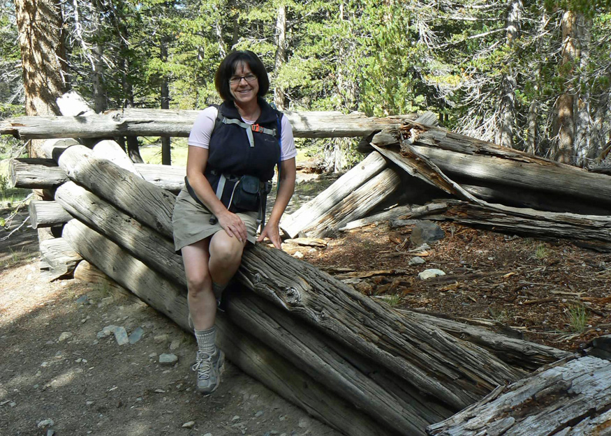
We soon saw the remnants of two cabins nestled near a scenic meadow. These cabins had been used by Basque shepherds (circa mid-1800s) who grazed their flocks in the surrounding grasslands.


We made our way uphill, emerging from the woods onto Mono Pass.


As we passed a nameless pond, we noticed a mine shaft in the distance, marked on the map. Departing from the main trail, we took the uphill spur trail leading towards the mine shaft.

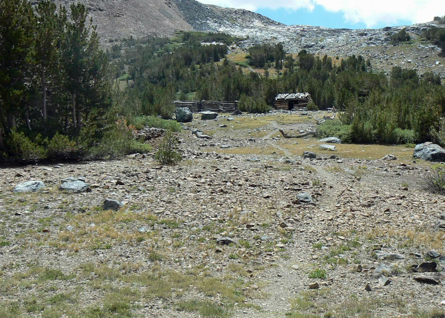
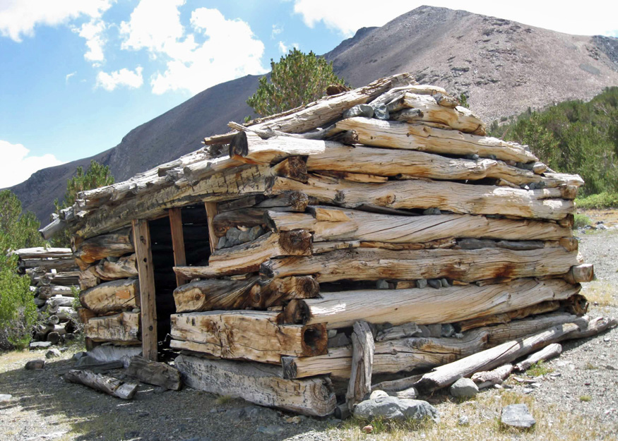
Heaps of discarded rocks called mine tailings surrounded the area, remnants of the miners’ efforts as they excavated to reach the ore below. Unfortunately, they found no silver, and the mine was soon abandoned shortly after it began.
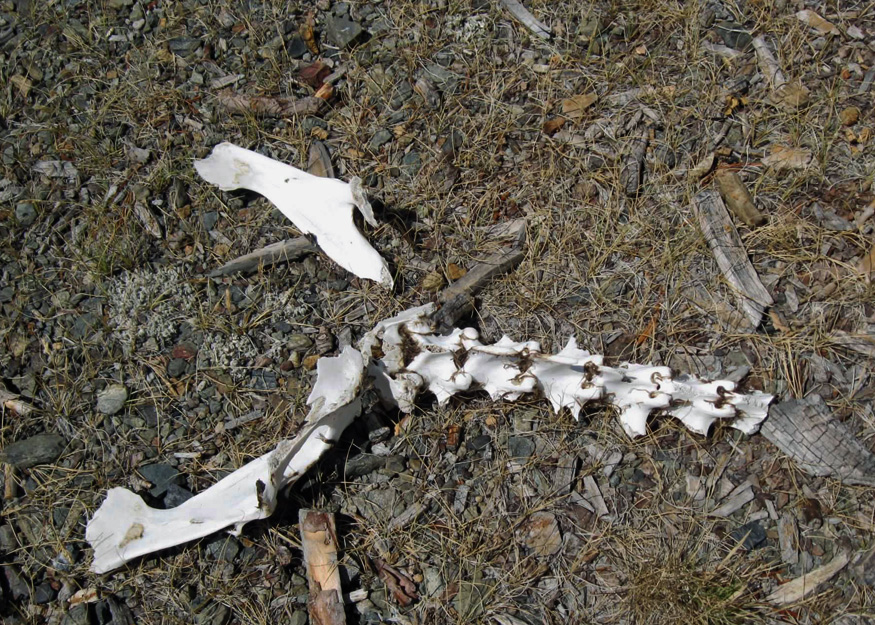
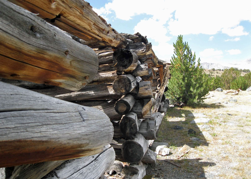
Scattered among the rock piles on the ground lay the fragments of an animal skeleton. In the vicinity stood four cabins, likely once home to the miners of the region. Their construction brought to mind Lincoln Logs. While some cabins were in good condition, others resembled the animal bones we saw, only partially whole.


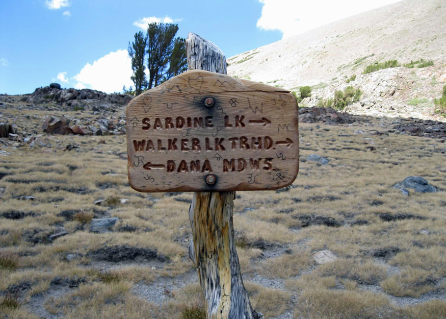
We left the windy area observing Clark’s Nutcrackers fluttering around. Continuing on the Mono Pass trail, we transitioned from Yosemite National Park to the Inyo National Forest and the Ansel Adams Wilderness.

Ansel Adams was a photographer famous for his black and white landscape photos. The area was expanded and renamed after his death in 1984. We noticed that with the change from national park to national forest came a switch in trail markers from rusted metal signs to wooden signs.

We strolled past Summit Lake, situated at the Mono Pass summit at an elevation of 10,599 feet, a charming small lake where a family was enjoying a picnic.

Sturdy-looking trees capable of withstanding harsh winters, dotted the landscape. The terrain shifted to dark reddish-brown shale, and the trail snaked its way through the undulating ground. Rounding a bend, Mono Lake came into view, spanning 65 square miles. Established over a million years ago, it is among the most ancient lakes in North America.

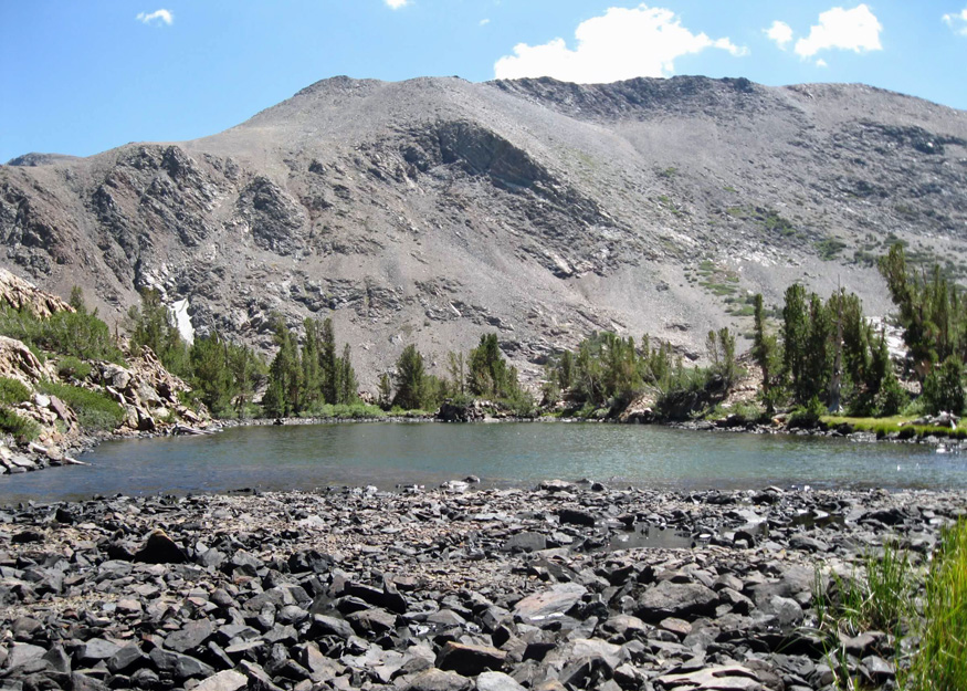
We made our way to the shore of Lower Sardine Lake, navigating through reeds and clambering over rocks. Upper and Lower Sardine Lakes supposedly got their name in 1860 from a pack mule weighed down with kegs of whiskey. The mule lost its footing and plummeted down a slope falling into Lower Sardine Lake taking with it another mule burdened with cases of sardines. Is this tale true? Similar tales exist about other Sardine Lakes in California.

We decided to make this our turnaround point. We headed back to the car, content with the thrill of yet another great day spent in Yosemite.

Janet,
Everyone should be so lucky to have a daughter who enables them to vicariously experience so many fantastic hikes.
Dad
LikeLike
Thank you, Dad. Maybe one day you can join me.
LikeLike
Thanks for sharing your beautiful photos! Looks like it was an awesome hike. 🙂
LikeLike
The area is certainly beautiful, I don’t know about my photo taking skills…but thank you. 🙂
LikeLike
Lovely photos and what an awesome part of the country to hike in. Hopefully one of these days I can try a few of those trails myself. Stay safe and keep on hiking.
LikeLike
What a gorgeous hike! I’d like to have that (miner’s?) cabin by my pond!
Thanks for stopping by!
LikeLike