August 31, 2012
Gaylor Lakes, Yosemite National Park
Total distance walked: 4.6 miles
My hiking buddy and I reached the trailhead earlier than usual. Anticipating heavy traffic on Friday due to the Labor Day holiday, we departed at dawn, only to be gladly mistaken. We entered Yosemite from the Arch Rock entrance and swiftly sailed over Tioga Pass. Our destinations were Gaylor Lakes, Granite Lakes, and the Great Sierra Mine.
While I relish solitary hikes, the presence of a companion offers a sense of security that solitude cannot. My fun friend Mary Elizabeth (M.E.) makes an excellent hiking buddy. Today, we emulated the bear from the song: we ascended various mountains “to see what we could see.”

The sky looked ominous as we embarked on our adventure. Hearing a distant rumble of thunder, my ever-vigilant friend and I discussed what steps to take should we find ourselves in the midst of a thunderstorm. Today’s excursion was a true test of our endurance, not in terms of skill, but in withstanding the relentless wind blowing at 30 miles per hour.
Beginning at an elevation of 9,950 feet, we ascended 600 feet over a half-mile stretch of rocky terrain. The view from above was amazing. We looked over at Mt. Dana, and down at the tawny Dana Meadows.
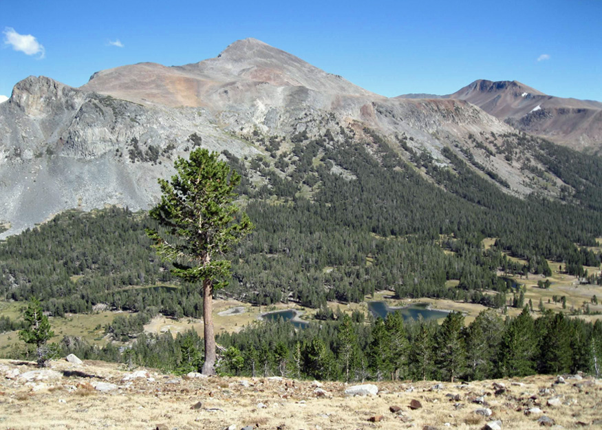
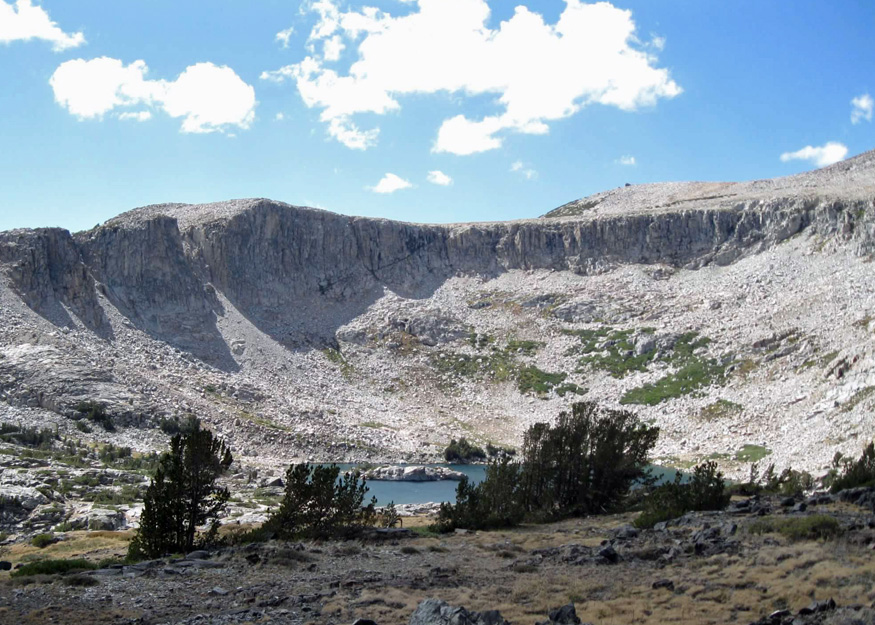
Following my lead, we veered off on a spur trail, but M.E. quickly corrected that gaffe—as any reliable partner would do—and steered us back to the main path. The trail leveled off at a plateau. From there one could climb Gaylor Peak. We ascended further until we triumphantly reached the summit of our first mountain, Gaylor Ridge, and gazed upon Middle Gaylor Lake below us. The trail then dropped 200 feet to the lake.


Looking southwest from the lake we saw the magnificent Cathedral Range rising above the water.
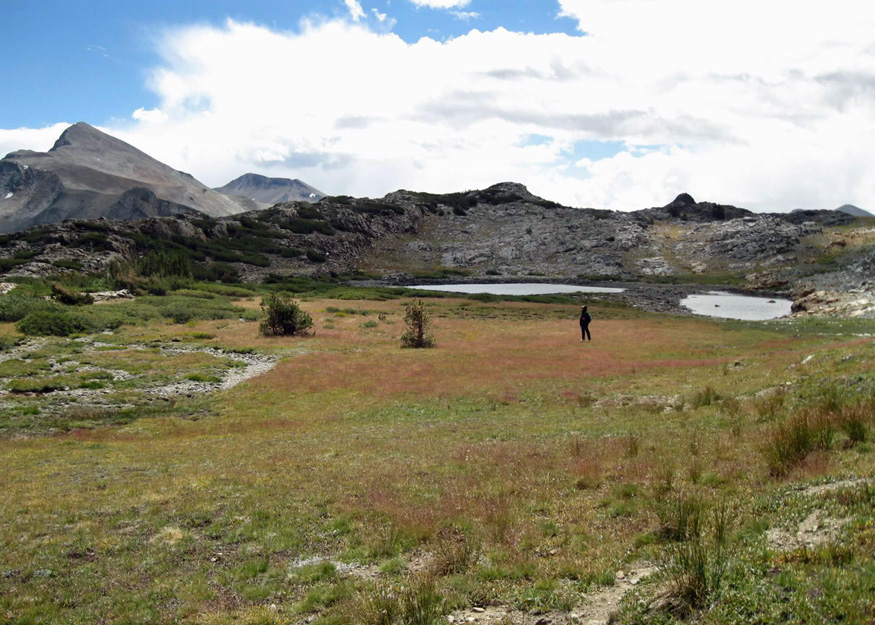
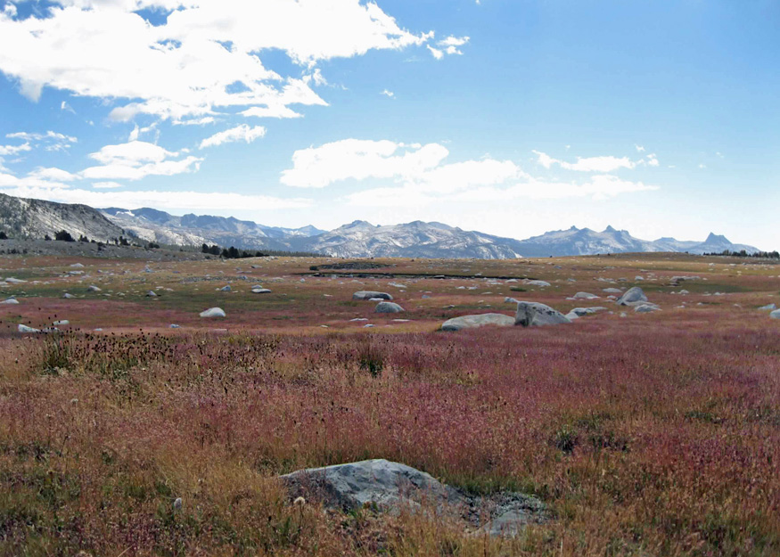
We observed the dark rain clouds as they advanced across the sky towards us. Departing from the shoreline trail, we started our ascent through the desolate terrain of the Gaylor Lakes Basin, heading northward. The trail skirted the dry creek bed linking Middle and Upper Gaylor Lakes where the grass of Parnassus grew.


As we walked, a rain cloud trailed behind us, prompting us to seek refuge under some wind-swept trees. However, the wind shifted, sending the mist away in a different direction.
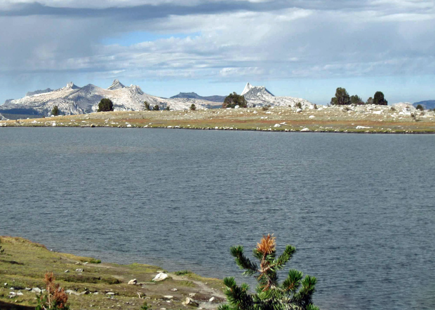
Moving forward, we arrived at Upper Gaylor Lake, nestled at the foot of Gaylor Peak. Looking north we could see the stone cabin sitting at 10,760 feet. We ascended the old miner’s trail to reach the cabin at the hill’s summit. Having completed our second ascent and now at the summit of Tioga Hill, we were ready to explore the historic Great Sierra Mine. This was where the official trail ended.


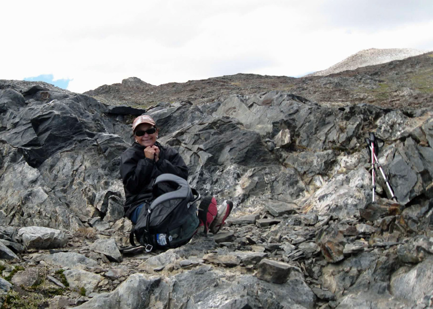
Besides the cabin atop the hill, we observed the remnants of numerous other stone structures.


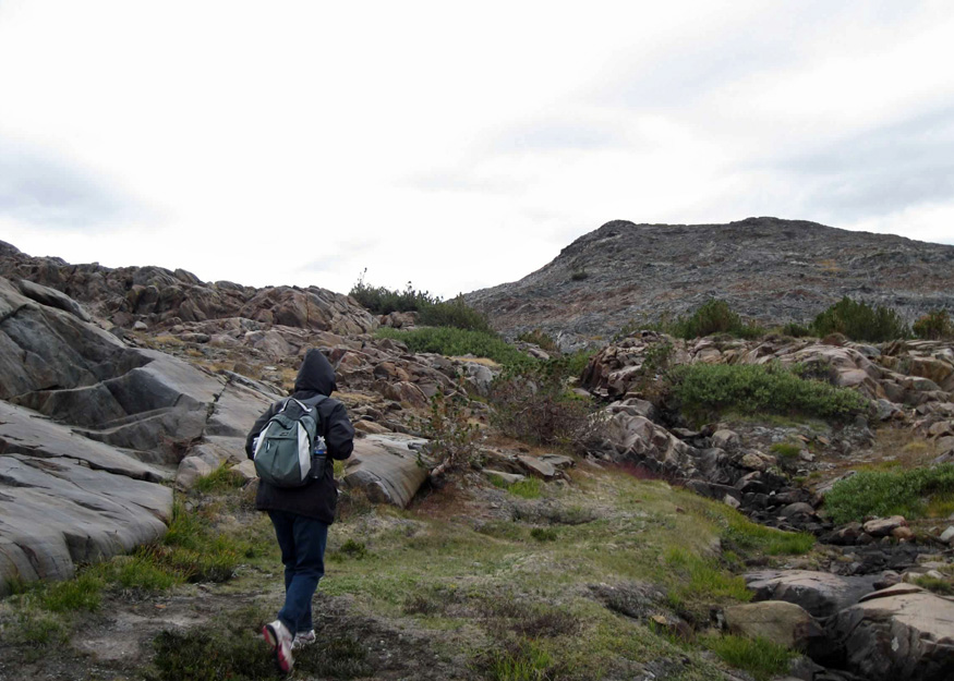
Roaming about, we peered into several collapsed mine shafts and observed that none of their openings were secured.


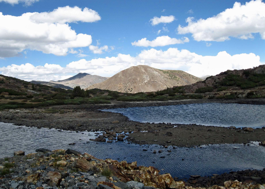
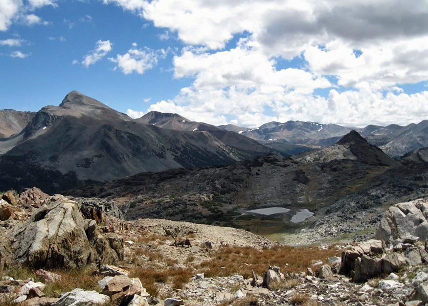
From above we spied two unnamed ponds. Walking between them felt like traversing quicksand.

Continuing our exploration of the Sierra Crest, we headed down a rocky hill away from the ponds and east toward Bennettsville. The map indicated that we were exiting the park’s boundary and were surrounded by mine shafts. Mysterious mining relics and colorful-looking rock formations adorned the area.


We headed back to the ponds by following a dry stream bed uphill, and successfully claimed our third mountain ascent.
The wind beat at us in the meadow, but the threat of rain had vanished. I was eager to hike up another mountainside north of the ponds believing that it would lead us to Granite Lakes. Uncertain, M.E. stayed behind while I quickly paced across the field to have a look.
My adventurous friend—an excellent quality in a hiking companion—caught up with me and was eager to conquer another mountain in search of the lakes. Upon reaching the summit of peak number four, we were greeted only by a col. Seeking refuge from the brisk wind, we settled down for lunch with a view eastward, towards Lee Vining and Mono Lake.
As we ate, we engaged in the whimsical activity of identifying shapes in the clouds, reminiscent of a childhood game. We discussed ascending the grassy mountain located to our north. It looked like a very easy ascent with a rewarding view from the top. We finished lunch and headed up.
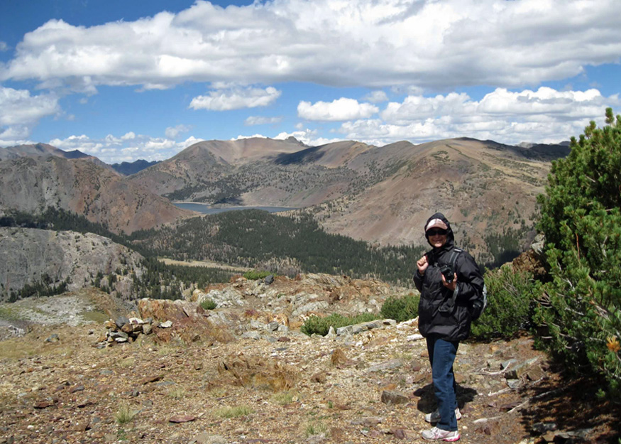
On the exposed mountainside, the wind was so fierce that M.E. had to wear two hoods and stuff tissue in her ears. When we reached the apex, we were elated not only for having hiked up our fifth mountain, but the panoramic picture before us was incredible. Looking north we could see Saddlebag Lak, the recent backpacking destination of M.E. and her husband. Gazing southward, it seemed as though we were in a face-to-face encounter with Mount Dana, Yosemite’s second highest peak.
Our adventure was drawing to a close. Though we didn’t locate Granite Lakes, I was pleased with what we did, with the scenery around us, the flora and fauna, the geological formations, and the remnants of mining history, even the clouds adorning the sky. As we made our way back to the official trail, M.E., an adept map reader—always handy in a hiking partner—studied the map and proclaimed that she’d like to climb one more mountain if I was game. She was convinced that the Granite Lakes lay just beyond the crest west of the stone cabin.

We began climbing the talus of our sixth peak. Upon reaching the summit, we inadvertently startled three deer that were grazing. Then, to our immense delight, a view of Granite Lakes unfolded before us.

Had we continued heading west from the start, instead of following the trail to Upper Gaylor Lake, we would have arrived at Granite Lakes. The two lakes lay hidden in a glacial cirque behind a low ridge about a mile away. The wind on the ridge continued to pound and batter us. Content with our adventure, we chose not to descend to the lakeshore instead heading back through the meadow. Marmots scurried between boulders while we traversed the desolate meadow of the Gaylor Lakes Basin.
The sky had cleared by the end of the day. Wind burned but pleased that we had reached all of our destinations and more, we agreed that it was our best and most fun hike yet.
Having a hiking partner can definitely add a layer of security and make the experience even more enjoyable. Plus, sharing beautiful moments and capturing them together creates wonderful memories!
“Doubly happy, however, is the man to whom lofty mountain tops are within reach.” —John Muir.

Janet,
Another great post. I would like to have seen more pictures of you. And what is that picture with the caption “W.I. Tustin Pioneer Manufacturer of Windmills Horse Powers
Pumps and Tanks S. F. Cal”
Dad
LikeLike
Beautiful pictures! 🙂 I saw you liked one of my posts and had to stop by!
LikeLike
Thank you, and thanks for stopping by. I’ve read most of your posts. 🙂
LikeLike
Really? Wow, I’m glad! I hope you enjoy them. 🙂 Glad to be of service.
LikeLike
Wow, great photos and great write-up! My wife and I hope to move south to your area when we retire. Thanks for sharing your hikes and making my “to do” list longer! 🙂
LikeLike
Thanks for following along. Yes, it’s quite a beautiful area. Gotta take advantage of it while we can.
LikeLike
You found Parnassia — I was looking for them all around Lakes Basin where I’d seen them year after year, but it seems they were delayed this year. Lovely to see that photo. I’m regretful we had to leave the field so early and your photos and blog make me even more so!
LikeLike
Sounds like you love wildflowers too. There weren’t many flowers there that day, but just a few parnassia left along the dry creek. Do don’t recall ever seeing them before.
LikeLike