June 4, 2012
Dewey Point, Yosemite National Park
Total distance walked: 8 miles
Julia and I seized the opportunity to hike together today. Disregarding the weather, we set out on the McGurk Meadow trail along Glacier Point Road in Yosemite National Park.

The morning was chilly, yet the sun shone brightly. The trail began with a descent through a pine forest dotted with many dead trees. As the wind blew, they emitted creaks reminiscent of squeaky doors creating an eerie symphony.

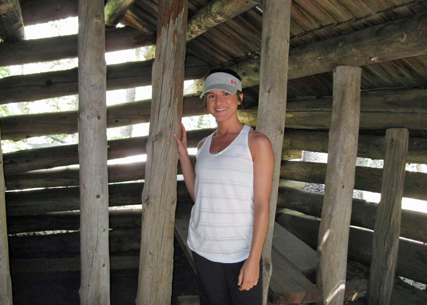
Shortly into our hike, we came upon an old decrepit cabin constructed in the 1890s by John McGurk. It served as his summer residence during the sheep grazing season.
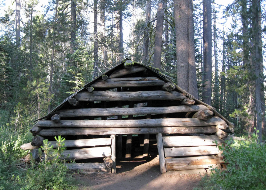
Just beyond the cabin lay a footbridge crossing a tributary of Bridalveil Creek. We crossed the bridge and followed a wet and muddy trail that led us to the meadow.
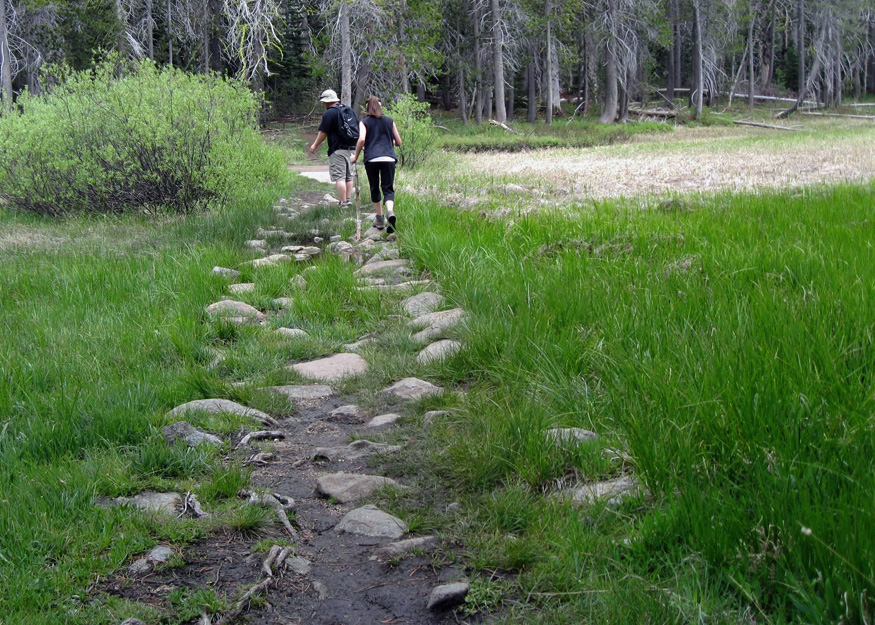
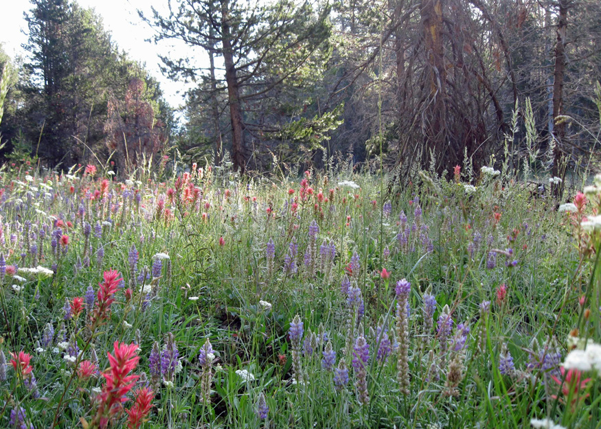
I’ve traversed this meadow many times and each time was greeted by a diverse array of wildflowers. However, this visit presented only a handful of lupines and a couple of shooting stars basking in the sunny patches.
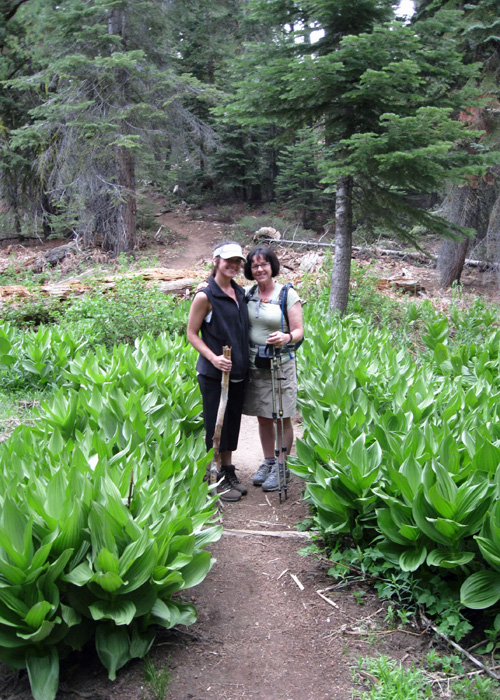
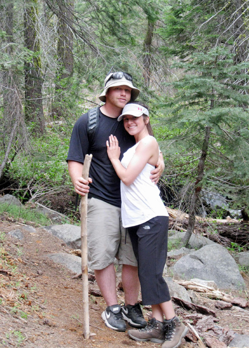
I had hoped for Julia to feel the joy I felt upon my first sight of the flower-laden meadow. Fortunately, her lack of expectations spared her any disappointment, plus she had a diversion—her boyfriend Mason accompanied us on the hike.
At the junction of the Pohono Trail, we veered left towards Dewey Point, walking through a shadowy forest where the harshness of winter was evident. Numerous downed trees and scattered branches littered the path, presenting us with a challenging and intriguing obstacle course to navigate.


We reached a clearing and observed that the sky was overcast. In this open space, the pussy paws were starting to blossom, and the phlox was already in its full bloom.


We crossed Bridalveil Creek once more before the trail started its ascent. When we arrived at Dewey Point, Julia and Mason scrambled to the rocky ledge.

Perched near the edge, I took in the sights of El Capitan, Cathedral Rocks, and the expanse of Yosemite Valley. The wind was brisk, and the sky loomed with the promise of rain, shrouding much of the distant scenery in clouds.

Seeking shelter from the wind, the three of us moved away from the exposed point. We continued onward, driven by the need for warmth and the looming threat of a rainstorm. Descending swiftly, we ate our lunch in haste, then stopped, captivated by the sight of two deer grazing in the meadow.


The downpour started as we reached the car. Later, the park had to close Glacier Point Road due to the storm. Even on the grayest of days, there’s a silver lining: having the rare opportunity to spend the day with my daughter and getting to know Mason better through this adventure.

This was a fun hike except for being freezing towards the end! But the hot chocolate at glacier point helped. 🙂 Thank you!
LikeLike
Maybe if you’re not working in the park next summer, you’ll want to hike more, or even go backpacking with us.
LikeLike