November 25, 2013
Pohono Trail, Yosemite National Park
Total distance walked: 8.8 miles
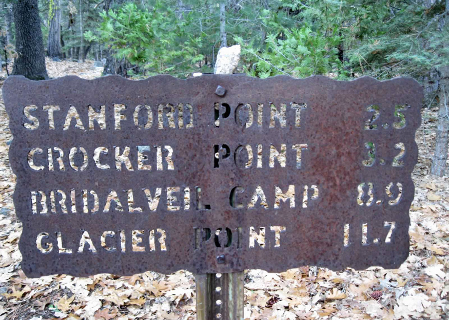
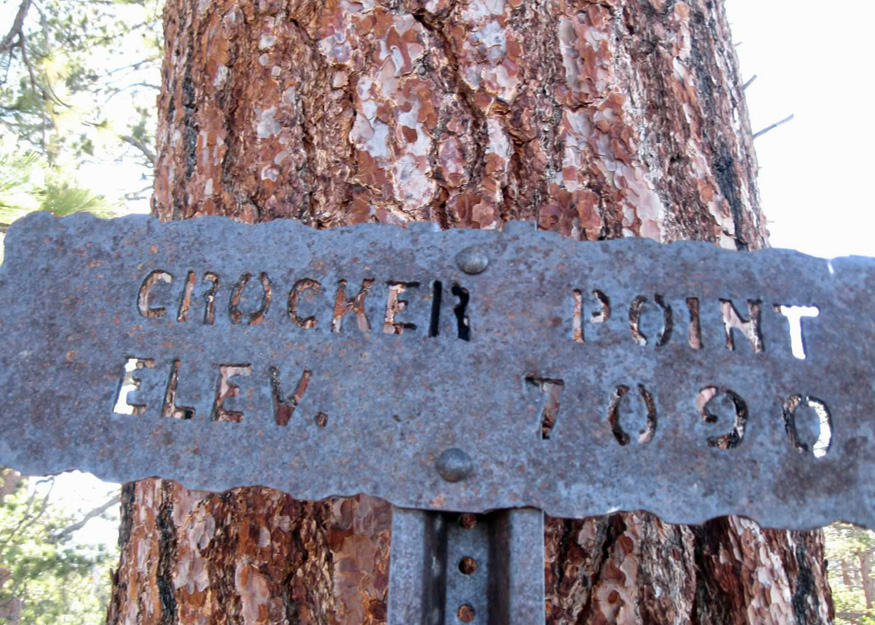
As the morning progressed, I busied myself around the house, slowly collecting my hiking gear. Andrew, who has been my reliable hiking companion since he came back from studying abroad, was still asleep in bed, having driven almost seven hundred miles the previous day. I wavered, uncertain about whether to go on a solo hike or stay at home. My plan was to walk the Pohono Trail to Crocker Point. The 13-mile trail offers several spots (or points) with scenic views of Yosemite Valley’s iconic landscape. I have hiked portions of it throughout the years: Dewey Point, Taft Point, the Pohono Loop to Sentinel Dome, and Inspiration Point, but always fell short of reaching Crocker Point.
The house phone rang—it was my neighbor asking to borrow a hiking book. Her family was visiting from Orange County, California and wanted to hike in Yosemite while they were here.

I mentioned to her that I was getting ready to go hiking myself and wondered if any of them would like to join me. She graciously declined, then phoned back minutes later saying, yes.
That was the push I needed to get going. I quickly stuffed a lunch into my pack and headed out. My hiking partner for the day was her sixteen-year-old grandson, Jonathan. This was my first time meeting him (and his parents) although I had heard many great things about them. He was game to go with me even though my sleepy-head son stayed home.

Jonathan, a high school sophomore, enjoys hiking. He and his dad hiked to Nevada Fall a couple of years ago. That, coupled with the fact that he is athletic (on the school track team and surf team) gave me confidence that he would do well on the strenuous trail.
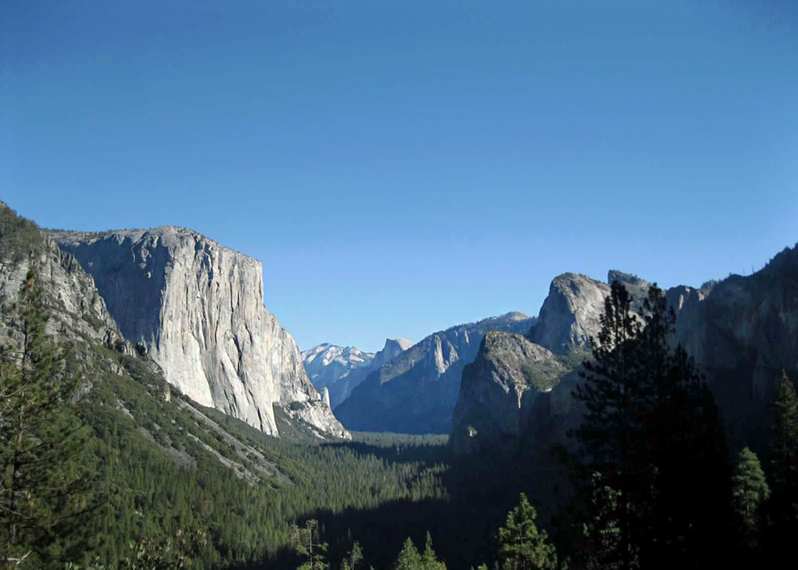
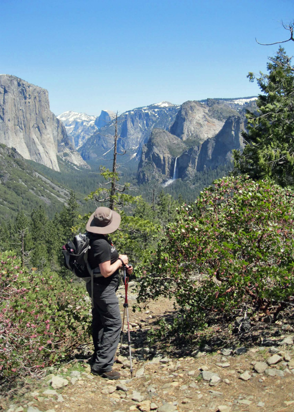
We began the hike at Tunnel View where you don’t even need to leave your car to see a panoramic view of the glacier-cut valley.
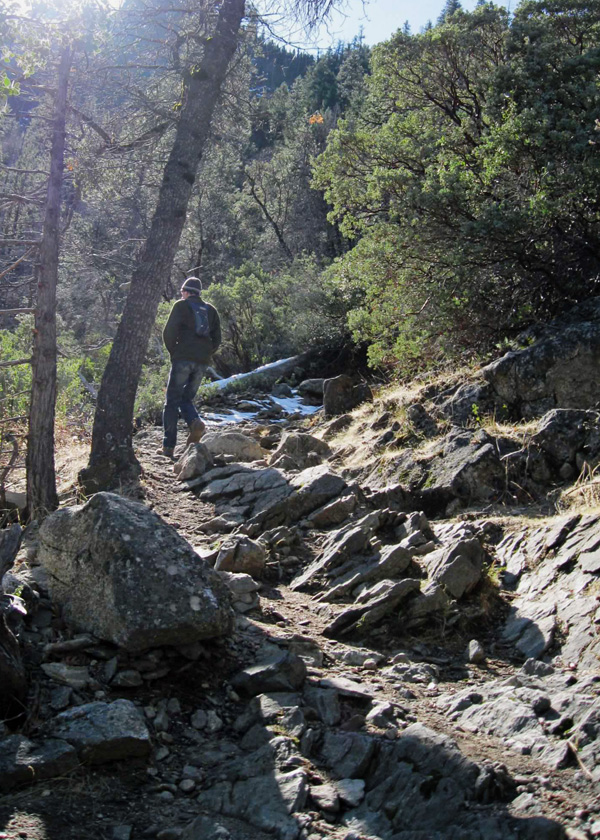
From Tunnel View, the rocky trail climbed around switchbacks. The cacophony of squealing breaks, humming tour busses, and slamming car doors faded away as we walked deeper into the wilderness.
In May 2011, Wendy and I carefully stepped from stone to stone trying to keep dry while crossing Meadow Creek. Jonathan and I crossed the creek as well, but the water was only an icy trickle, too small to form Silver Strand Falls that is sometimes visible from Tunnel View.

We paused at Artist Point where there is a great view of Bridalveil Fall.
Continuing uphill, we reached Inspiration Point where back in January 2012, Andrew and I hiked through snow to reach it. This time Inspiration Point was dry.

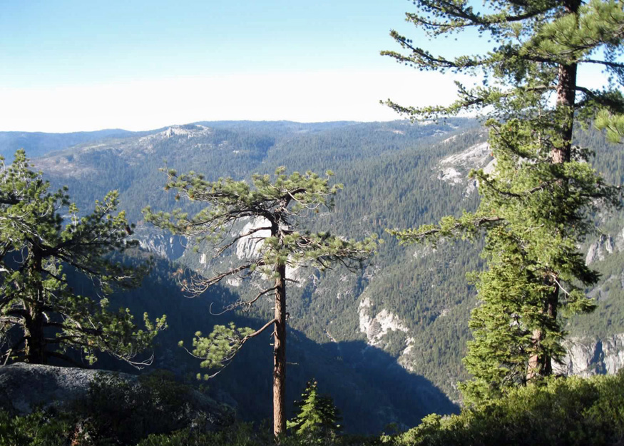
Jonathan noticed the changes in the trail as we gained elevation from the lower zone of mountain chapparal to the upper zone of lodgepole pine and red fir trees. The forest floor was littered with fall’s brown leaves then frost, ice, and snow.

Birds bantered back and forth, and grey squirrels foraged. While hiking through a wooded area, two hikers came from behind, passed us and we never saw them again.

As we ascended, we approached the snow line. The path grew icy in exposed areas, and the cold numbed our hands and cheeks.

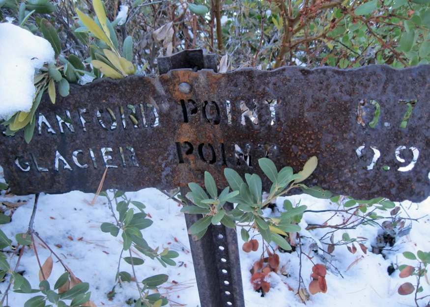
We reached Stanford Point first where a spur trail took us to a less spectacular view.
The snow deepened as we continued from Stanford Point to Crocker Point.

Intricate blades of ice glistened in the sun.

Although there were no flowers on the trail, there was beauty in what was left behind.

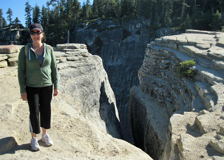
The approach to Crocker Point was sunny and void of snow. We stood facing the sun hoping to capture the warmth from its rays. When we left the car, it was a brisk thirty-four degrees. The two thousand seven-hundred-foot climb caused us to sweat, but didn’t warm us.

The view at the top was breathtaking. A sea of granite opened up before us.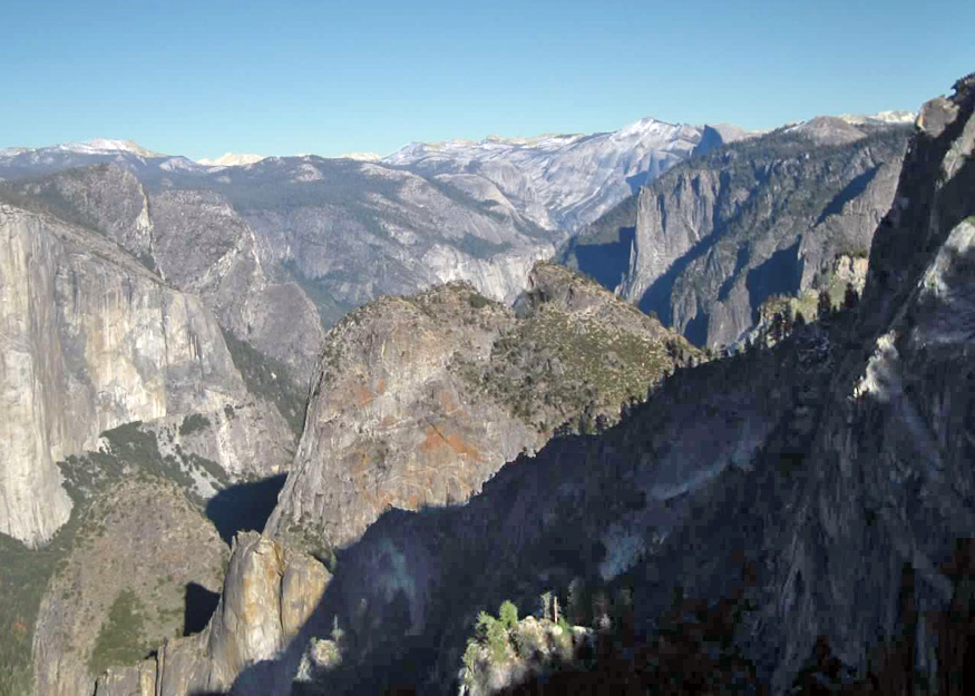
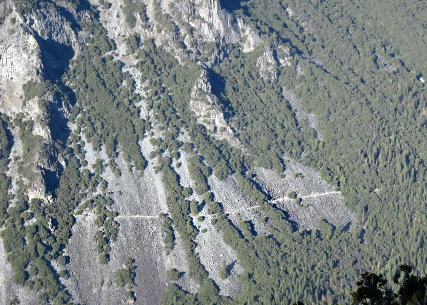
Reaching Crocker Point took us three hours. As we ate lunch, we strolled around, taking in the sight of the rust-stained formations below us. Looking down, I could clearly see Old Big Oak Flat Road (the Rockslides Trail) that I had been trying to find on the last day of summer.
We stayed only a short time at Crocker Point before returning downhill at a break-neck speed: through the snow, past Stanford Point, Inspiration Point and Artist Point, over the rocks and down the last granite steps of the day as the sun sunk low in the sky.


Jonathan’s words when we reached the car, “It feels good to sit down.” It certainly did!
It was definitely worth the effort to get to Crocker Point with its serene and less crowded atmosphere. I thank Jonathan for coming with me even though it may have been awkward to do so. Without a partner, I would have turned around at the snow line and would not have reached Crocker Point.
