May 5, 2017
Valley Loop Trail, West End, Yosemite National Park
Total distance walked: 6.4 miles
I woke to the news that the Merced River in Yosemite Valley was at flood stage—a day I planned to hike there. I wondered if it was prudent to go but found it hard to stay home. John Muir said, “In the face of Yosemite scenery, cautious remonstrance is vain; under its spell one’s body seems to go where it likes.” I grabbed my things and headed out the door.
Driving through the Arch Rock entrance, the surrounding hills wept with water.
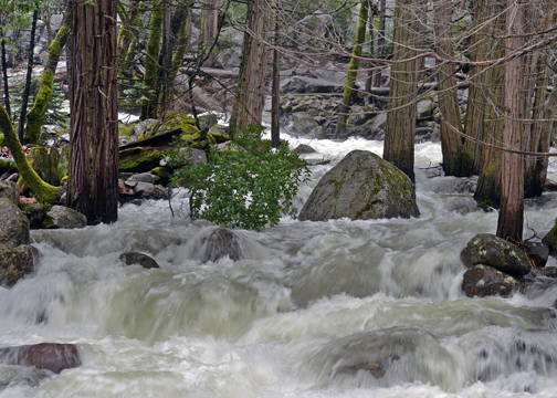
The river, swollen by snow runoff was ten feet high under Pohono Bridge. Fern Spring bubbled onto the roadway causing deep puddles that cars sloshed through.
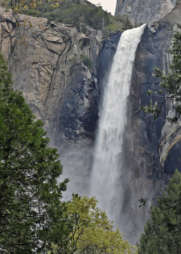
A deluge of water rushed downhill settling in the parking lot of Bridalveil Fall, where my hike began. I tiptoed through it and accidentally dunked a foot. The cold wetness seeped into my shoe but didn’t hinder my hike.
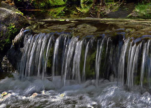
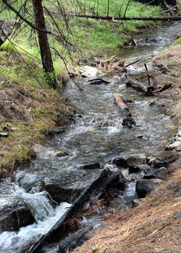
I watched water tumble over rocks in Bridalveil Creek enchanted with its beauty and power.
People milled about on the three bridges above the creek watching water surge toward lower land. Mist from the fall covered my glasses.
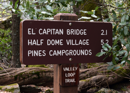
Heading east, a trail sign pointed me in the direction of the Valley Loop Trail. I was doing the west end loop, seven miles.
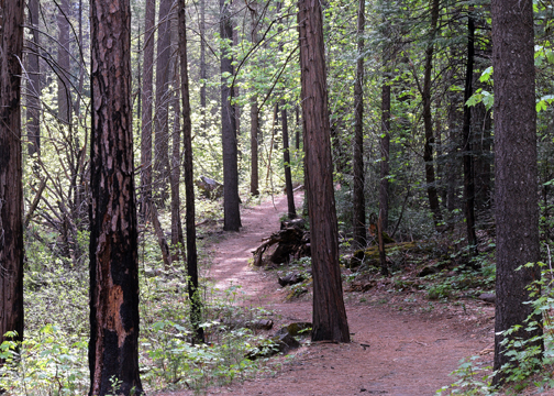
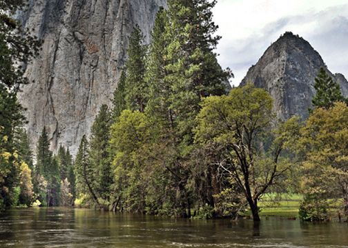
Alone on the trail, I followed the path as it climbed around the base of Cathedral Rocks.

A faint climbers trail led uphill toward the rocks, a path I did not take.
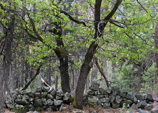
It was peaceful in the heart of the woods strolling underneath pines, furs and oaks. There were cedars and big leaf maples. Dogwoods grew below the trail near the roaring Merced River.
I spotted a large marble butterfly feeding on a flower, the likes of which I had never seen before. A park ornithologist had this to say about my sighting: “Marbles are highly visible signs of spring. Through anecdotal reports, the large marble is regularly seen this time of year in Yosemite Valley, and this year seems to be particularly good for butterflies in general. However, we have not done any recent butterfly surveys in Yosemite Valley to know empirically how relatively common or uncommon this species is.”

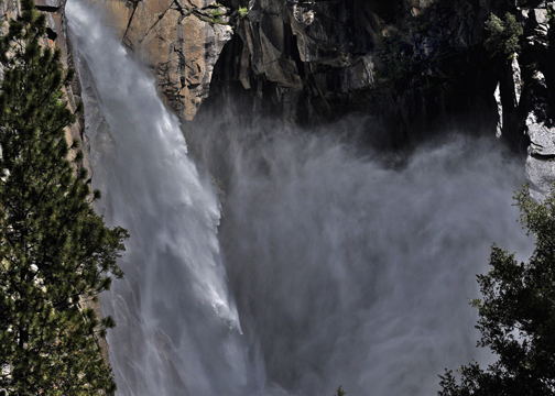
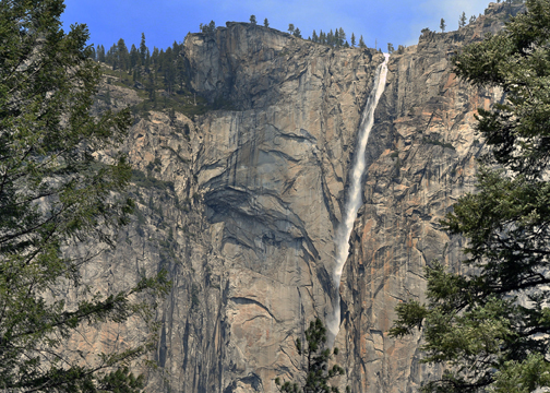
A clear view of Ribbon Fall opened up through the trees. I paused to observe the spectacular scenery. Later I would be below the fall where the Valley Loop route passes over Ribbon Creek.
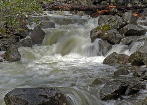
Water rushed over the trail. I hopped over with the help of a wet rock or two. That was easy, I thought.
The route crossed the roadway. I stopped to let traffic pass then headed back into the forest toward the Merced River. A sandy area led to a beach by the river, a great place to hang out come summer.

It wasn’t long until the path near the river became squishy, and water appeared on the trail. Heading off into a thicket of trees and a spongy forest floor, I spent ten minutes looking for a way around. Water was everywhere. There was nothing left to do but roll up my pant legs and take off my shoes.
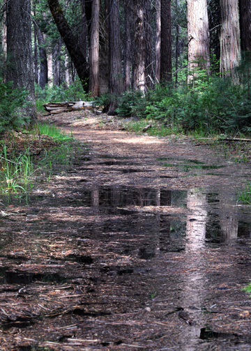
Soil and pine needles topped the water’s surface. I picked up a dead tree branch and poked the trail to determine its depth—ankle deep—then set out. Whew, got through that, I thought while putting on my shoes, but it was short-lived. Once again, I plunged into the water. It was nearly knee deep this time, as cold as ice, and was slowly moving towards the river. I quickly waded through until reaching terra firma. A little bit of water won’t stop me, I thought as I donned dry footwear.
I crossed the El Capitan Bridge to the next section of trail: the riverbank. It was completely submerged so I walked on the adjacent roadway. Heading west, I picked up an old dirt road toward Pohono Bridge.

This side of the valley was sunny, dry and warm. Instead of towering trees, I walked under the nose of El Capitan.
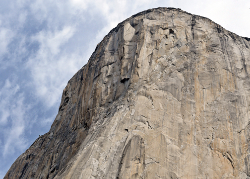
Hearing shouts from above, I scanned the rock face and was able to pick out two climbers. After briefly watching them, I continued on the flat, sandy path until the trail disappeared underwater. Deep water. Not again, I thought. Walking through this would not be prudent. I’m not gonna do it. Waylaid by water, there was nothing else to do but turn back.

Somewhere under El Cap, I spotted a narrow side-path. For kicks, I took it just to see where it would lead.
The side-path emerged on Northside Drive near the El Capitan Bridge.

To bypass the wet section of trail from earlier, I walked along the roadway and eventually returned to the wooded trail back to the car.

That morning Yosemite beckoned. By heeding its call, I embarked on an unexpected and glorious adventure. The extreme water conditions hindered my loop hike but allowed me to experience the trail in a unique way. How marvelous it is that Yosemite is ever-changing.
“Human nature is like water. It takes the shape of its container.” –Wallace Stevens
