May 21, 2021
Loop Hike, Black Diamond Regional Preserve
Total distance walked: 4.82 miles
It was a breezy Friday morning with strong winds predicted later in the day. Like I did in April, I was hiking through the Black Diamond Regional Preserve, once known as the Mt. Diablo Coalfield. I drove to the official entrance gate and was fifth in a line of cars waiting to get in. The ranger opened the gate at 8 AM on the dot.
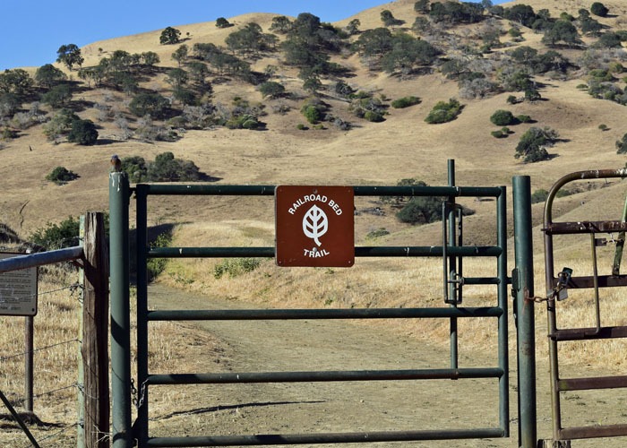
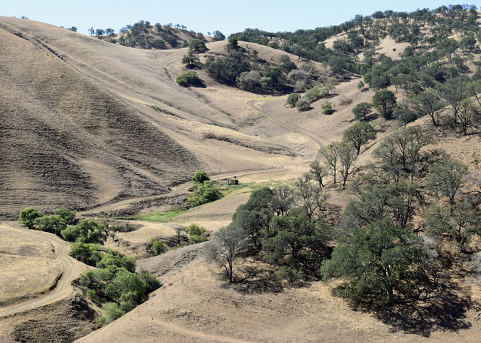
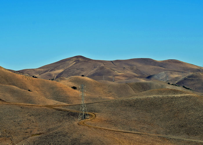
From the Sidney Flat parking area, I started by walking on the Railroad Bed Trail. It meandered broadly through Markley Canyon. Golden foothills surrounded the trail and provided protection from the wind.
This trail once held train tracks of the Pittsburg Railroad. Three railroads served the coalfield: the Black Diamond, the Pittsburg, and the Empire Railroad. They helped in hauling large amounts of coal to three different towns along the San Joaquin River. During World War I, the Pittsburg Railroad was sold and dismantled for scrap metal.
I kept a close eye on my map and the trail signs since I was covering a series of six trails that morning.
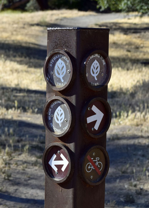
One thing I noticed on the map was the American Discovery Trail. It is a cross-country trail stretching from California to Delaware and is made up of many trails along the way that pass through cities, towns, farmland, desert, and wild areas. The trail covers over 6,800 miles. The ADT runs through the Preserve on the Stewartville Trail. I veered onto the Stewartville Trail leaving behind the historic railroad bed.
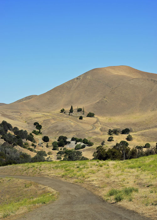
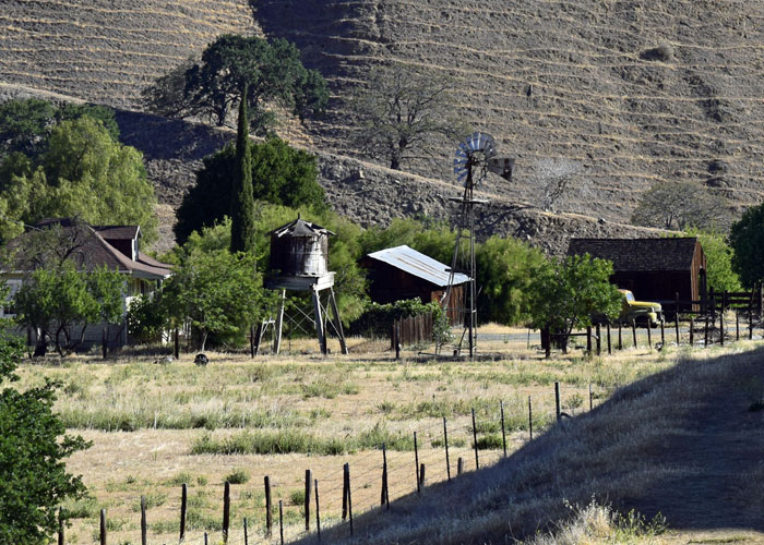
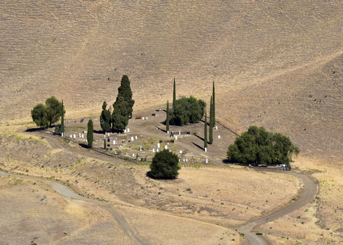
On a hill in the distance sat the Rose Hill Cemetery. The higher I climbed, the better I could see it. Although there is not much left from the coal mining community, the cemetery serves as a monument to the former residents of the five towns in the coalfield: Nortonville, Somersville, Stewartville, West Hartley and Judsonville.
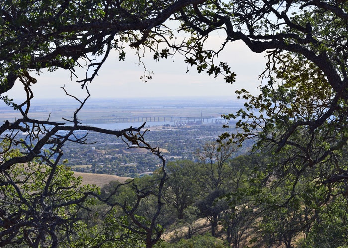
From the Stewartville Trail I walked for a short distance on the Ridge Trail which skirts Lone Tree Valley. Looking down from the top of the ridge was an old miner’s trail, another loop trail within the Preserve.
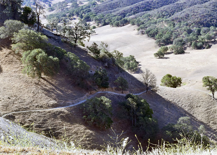
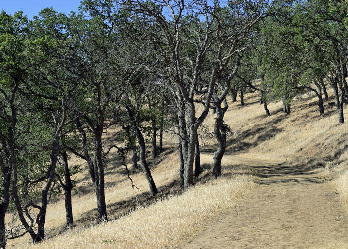
Departing the Ridge Trail, I strolled downhill on the Acorn Trail, which is suitably named since it runs through an oak grove.
The Acorn Trail ended at a fork in the road. Holding the map that I printed at home in the sunlight, I squinted to see which way to go next.
I turned west onto the Old Homestead Loop and walked through a cattle gate. Just then a slender coyote jumped from the gully startling both of us. It trotted across the trail and off into the field.
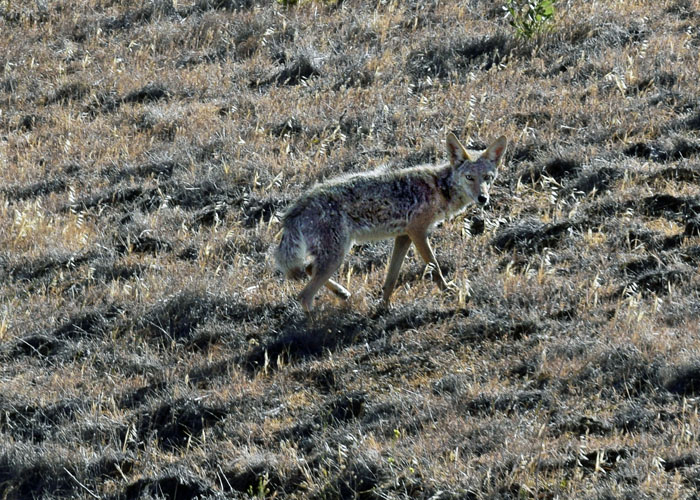
Despite walking through several cattle gates, I saw no cows or even diarrheal cow splats anywhere that day. I found it amusing that I was concerned about meeting cows on the trail but was excited to see the coyote.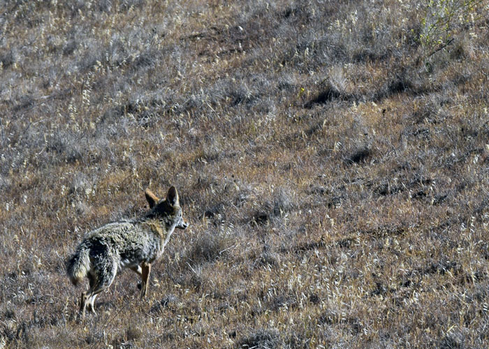
I headed north on the Old Homestead Loop weaving downward through rolling hills.
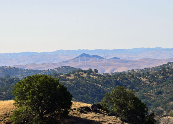
At a junction, I turned onto the Lark Trail unsure if it would head uphill. Once the path turned west, I was mounting a completely exposed hillside.
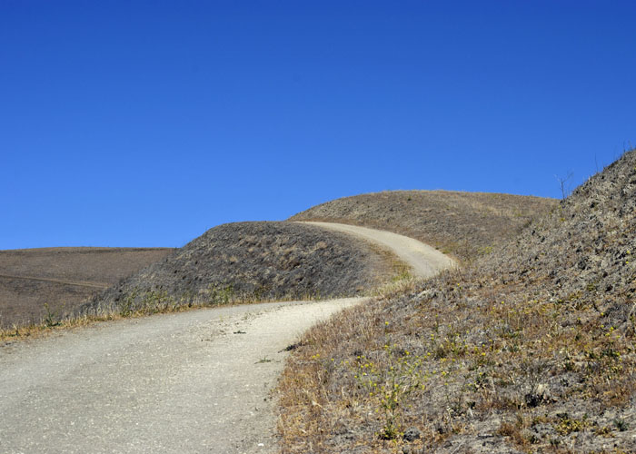
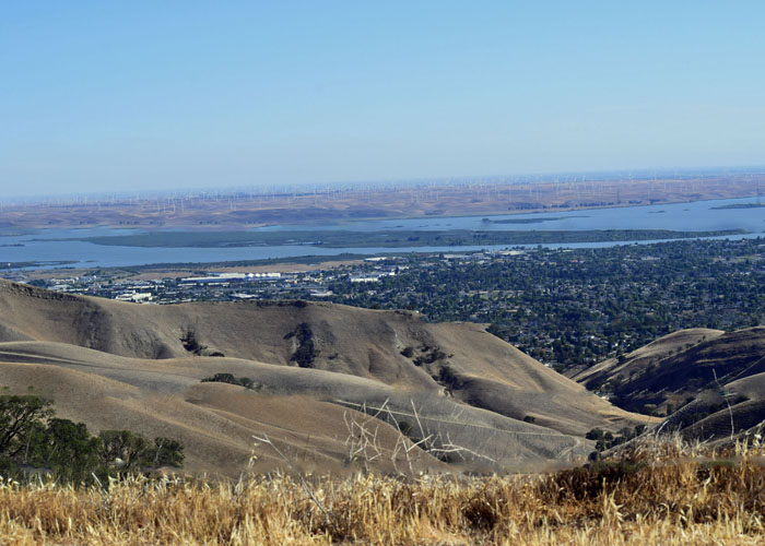
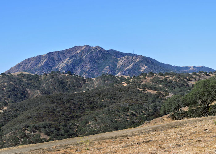
At the summit, wind buffeted my hair but the view was wide open.
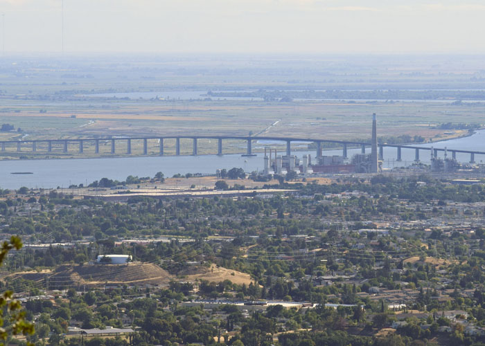
I walked a short distance more and came to a fork in the road. The loop continued another three miles, but I took a short-cut on the Riverview Trail back to the car.
I spent most of my life near the coal mines never really having explored the area. It took moving away and coming home for visits to really appreciate the history and beauty of the northern foothills of Mt. Diablo.


Love that you are coming around on the old rusty stuff 🙂
LikeLiked by 1 person
Beautiful photos and a nice description of the trail. My cousin lived in Antioch for many years and I wish I knew this trail was nearby. I would have loved to scout around on it. Thanks for sharing this
LikeLiked by 1 person
🙂 Thank you. Yes, there are lots of trails in the Preserve that I have yet to see.
LikeLike
I loved hiking vicariously through you again. Great photos and descriptions, both historic and scenic.
LikeLiked by 1 person
🙂 Thank you, Cari.
LikeLike
This was wonderful, Janet. Thanks for sharing!
LikeLiked by 1 person
Thank you, Linda. 🙂
LikeLike
Beautifully framed shot of the bridge from the ridge trail. I love the wind buffeted your hair:) happy trails
LikeLiked by 1 person
Thanks, Cathy. Do you ever go up in that area?
LikeLike
So fun to read that you are out and about hiking. Was hearing about our severe California drought, and while I love your photos, they always add to the story. I was shocked to see how very dry those hills are. I am sure you were surprised by the coyote, I sure would have been. Happy Hiking!
LikeLiked by 1 person
Hi Terri! Yes, the coyote really startled me. 🙂 The hills don’t stay green long unfortunately. I hope it’s a good fire season this year. Hope you’re well.
LikeLiked by 1 person
I am afraid of what fire season is going to bring. Coyotes seem to be everywhere. Even living in the city, we had one come to our front door and it showed in the early morning hours on our Ring. I just never know what they will do, so to have one cross my path like you did, would be startling. We are well and hope and Chris are as well.
LikeLiked by 1 person
Great shots of the coyote!! That must have been quite a surprise to see it along the trail. It’s kind of funny how we tend to take the area where we live for granted in some ways. Glad you were able to more fully explore the area.
LikeLiked by 1 person
Thank you. Yes, I’m really having fun exploring that area. I hope to go back this month.
LikeLiked by 1 person
Beautiful pictures and narrative! Thanks for sharing.
LikeLiked by 1 person
🙂 Thanks, Peggy. 🙂
LikeLike