June 11, 2018
Gaylor Lakes and the Great Sierra Mine
Total distance walked: 5.25 miles
I often wonder why I want to hike the John Muir Trail. The most obvious reason, of course, is to see the spectacular countryside. But amazing landscapes surround me without hiking what equals—in my case—seven marathons, or without packing and unpacking a tent every day. During a late-spring hike in Yosemite National Park, I finally figured out why.
I was up at dawn heading to the east end of the park to visit an old mining area. There was a photo I wanted to shoot up at the mine and was excited to get there.
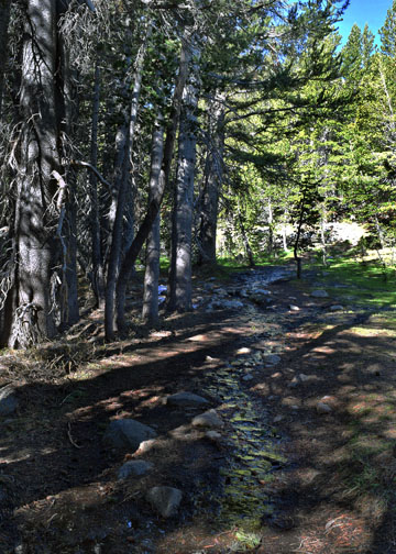
The hike began at an elevation of 9,950 feet just west of the Tioga Pass entrance. The trail climbed through a shaded forest where a couple of deer, mottled in color, munched on their morning greens.


Water slid down the mountain following the path of the trail. The uphill trek was relatively easy, but I stopped several times to catch a breath—not a good sign as most of the JMT is above 9,000 feet in elevation.
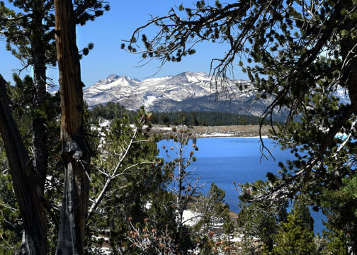
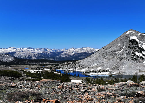
The trail crested then dropped down into the glacial basin. Not only did the high elevation leave me breathless, but so did the scenery.
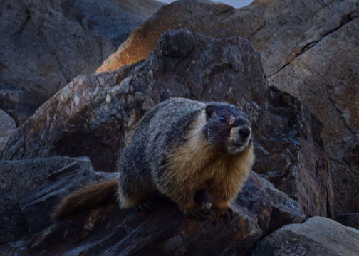
A marmot—which is actually a large squirrel—greeted me on the way down the rocky path.
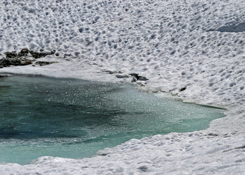
I passed a fisherman at the northeast end of Middle Gaylor Lake.
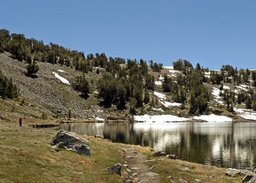
The water was filled with chunks of ice, but that didn’t stop the angler from trying his hand at fly fishing.
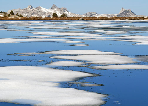
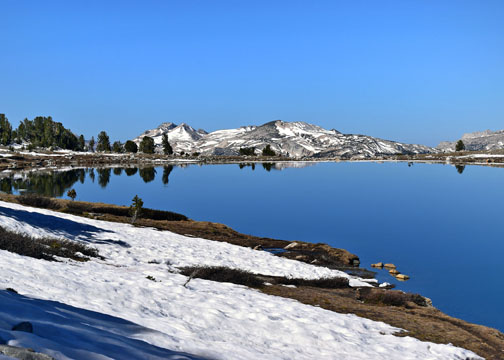
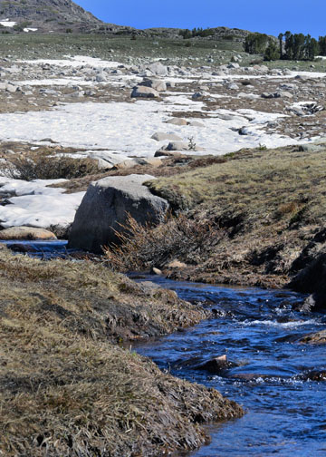
The trail crossed the lake’s inlet. I traversed the rocky alpine meadow to Upper Gaylor Lake crossing the creek a couple of times to keep from walking in the snow.
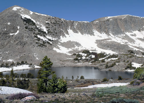
The path to the Great Sierra Mine was quite visible from the south end of Upper Gaylor Lake.
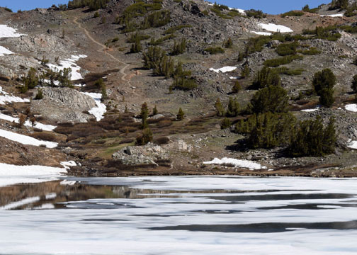
I should have been able to access the Great Sierra Mine trail from the lake, however the access point was covered with snow. I am not experienced in walking through snow banks, especially not over water. My thought was, I didn’t come this far to have to turn around.
I knew that I would not get lost, so I left Upper Gaylor Lake and forged my own path west through the basin passing Upper and Lower Granite Lakes.
Lower Granite Lake is one of my favorite Yosemite lakes. I planned to have lunch there on the way back.
Upon passing Lower Granite Lake, I headed north and eventually turned east towards the top of Tioga Hill approaching the mine from the backside.
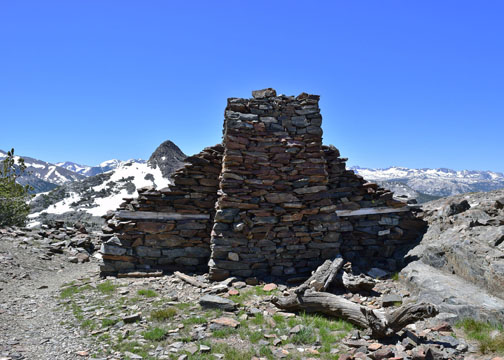
The Great Sierra Mine is a historic site. It was an unprofitable silver mining effort founded in 1881. Behind the stone cabin are several more mining relics from that bygone era.
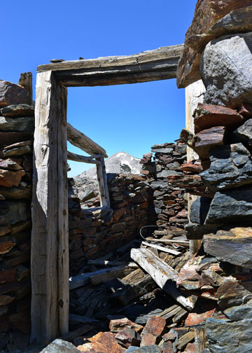
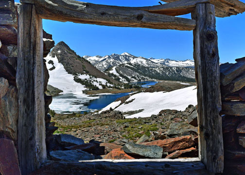
My reason for the day’s trip was to photograph Upper and Middle Gaylor Lakes through the crumbling cabin’s window frame.
After accomplishing that, I made the circuitous trip back. The hiking time limit I gave myself was almost over. I had a long drive home and people were counting on me to be home at the predetermined time. I wouldn’t be able to sit at Lower Granite Lake for lunch. That’s when I realized why I want to hike the John Muir Trail: so I can have all the time I need to saunter through the mountains, explore, walk, and to experience the freedom of living in the wilderness.
JOHN MUIR TRAIL UPDATE: Trip details have come together. Chris will meet me on Day 6 to bring a resupply of food. He will also bring Andrew and Sarah. We will spend the day together at Reds Meadow Resort in a cabin that sleeps five. Erin’s group will walk with me until Day 7, at which time they, along with Andrew and Sarah, will head out at a quicker pace. I will walk alone for the remaining time. A little over two months until we leave!

Thanks for making this trek and letting me tag along. I love the photo you took, using the window as a frame of the lakes. Impressive! I wish you luck on your upcoming trek on the JMT. Have fun!
LikeLiked by 1 person
Thank you. I always appreciate your comments.
LikeLike
Janet, how long will you be hiking the JMT alone? You are a brave woman! Red’s Meadows is my old stomping grounds and just feels like home to me, you will love the area if you haven’t been. I can’t wait to read about your experiences and journey. There is nothing like getting into the back country to see beauty that appears untouched, not many do it and can see the beauty and appreciate the lessons learned along the way. Beautiful photos and this hike looks beautiful.
LikeLiked by 1 person
Terri, I’ve never been to Red’s Meadow. I’m looking forward to it. I’m sure I’ll think about you when I’m there. I’ll be on the trail about 17 days after Red’s if all goes well. 🙂
LikeLike
I am so anxious to hear about the trip and see your photos. While at Red’s Meadows I’m sure you will eat at their little cafe, we go every time we are up there. The atmosphere of the diner set in the mountains is really special. Have fun, be safe and enjoy!
LikeLiked by 1 person
Hi Terri, I have read a lot about the food at the Mule Café. I’m already looking forward to it. 🙂
LikeLike
Your picture of the lakes framed by the old cabin is really beautiful! Now, I see why the beauty you will see on your trek will be incomparable!
Sheelah
LikeLiked by 1 person
Thank you, Sheelah. 🙂
LikeLike
The Gaylor Peak photo is awesome. One of my favorite.
LikeLiked by 1 person
I’ll print it for you.
LikeLiked by 1 person
So beautiful!! Getting close!
LikeLiked by 1 person
It is. 🙂
LikeLike
Great hike. All the photos are fantastic, by the one taken through the cabin window is outstanding!
LikeLiked by 1 person
Thanks, Dad. 🙂
LikeLike