February 25, 2016
Little Nellie Falls
Total distance: 5.6 miles
The waterfalls were flowing in Yosemite National Park. To avoid hundreds of spectators, Chris and I hiked to Little Nellie Falls just outside of the park in the Stanislaus National Forest. The trail began inside Yosemite near the small subdivision of Foresta, an area that has seen its share of wildfires. For most of the way, we would walk through a burned area.
Just beyond the trailhead we passed through Big Meadow. Back in 1990 the lightening-caused A-Rock Fire burned there (the second largest fire in Yosemite). In 2009 the area burned again during the Big Meadow Fire: a 91-acre prescribed burn that got out of control. Over 7,000 acres were torched, but the meadow itself along with the barns were spared.

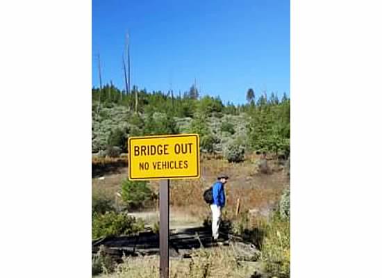
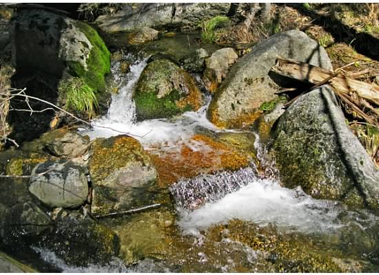
As we left the meadow, I thought of bygone days when Native Americans lived there. Food would have been plentiful with acorn-laden oak trees and nearby Crane Creek teeming with fish. Now a rickety bridge led us across the creek where the uphill road was rocky and the oak trees crisp and dry.
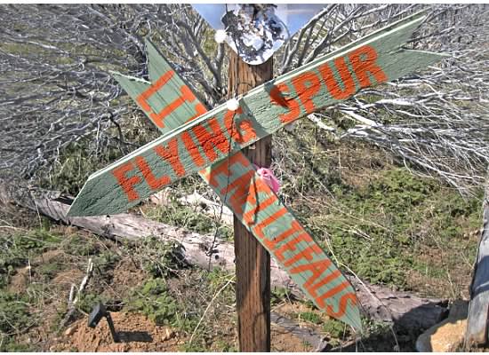
The route on Old Coulterville Road was chewed away and deeply rutted in spots. Water runoff from rain caused much erosion. At the top of the hill was a fork in the road with wooden arrows pointing the way.
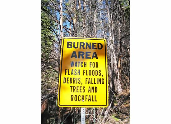
As the burned area of the Big Meadow Fire ended, scars from the El Portal Fire began. The El Portal Fire started on July 26, 2014 and burned over 4,600 acres.


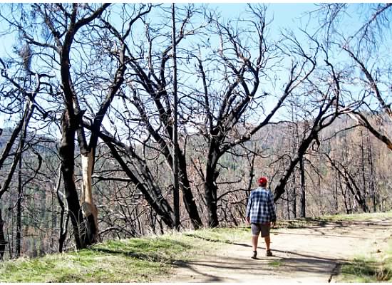
Morning light streamed through the branches of charred trees as we plodded along. The trail was covered with deer tracks, dog prints, tire marks and muddy puddles. Mountain misery crept up and down the slopes preventing erosion in the burned areas.
Somewhere under the mass of blackened trees, Chris notified me that his spidey-senses were tingling. Translated: He thought maybe we had taken a wrong turn on the winding path and didn’t want to walk farther than necessary (remember, he’s not a hiker). As we left the park boundary and heard the music of falling water, we knew we had gone the right way.

Little Nellie Falls is not a waterfall with dramatic drops. The hike through dry chaparral and burned countryside isn’t spectacular. For those reasons it is not a popular destination.
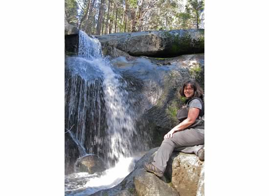
We enjoyed the area in solitude watching water tumble over the rocks, then crossed the creek (without benefit of a bridge) to get upstream. The creek burbled along the rocky bed near where we sat for a rest before heading back.
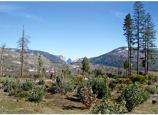
Though we saw views of Eagle Peak and Buena Vista, the view of El Capitan and Half Dome on the horizon was the best of the day.
Whether prescribed or natural, fire renews an area promoting plant and wildlife diversity. It felt good to be out on this spring-like day in February walking through the altered landscape of the burned area.

Beautiful. Every time I read your posts, I want to be there.
LikeLiked by 1 person
Thanks! I didn’t know you read the posts. Chris is looking forward to you moving here so that you can hike with me instead of him. 🙂
LikeLike
You are able to find beauty in the midst of devastation! I particularly liked the Flying Spruce sign and the 1st Street sign! What is that object on the top of the post crossing that says Flying Spruce?
Great photographs and text! I love your use of descriptive adjectives!
Sheelah
LikeLiked by 1 person
Thank you, Sheelah. It’s another metal sign above the two wooden arrows. I don’t remember what it said. If you notice in the photo, you can see a small solar panel on the ground. It’s used to light a string of Christmas lights that are hung around the sign. I guess there are homes hidden from the trail on Flying Spruce. The lights must shine brightly at nighttime out there.
LikeLike
You always write with insight, attention to ecology and history as well as the senses. I agree with the other post-er — I always wish I could be walking alongside with you and Chris, asking questions or just listening.
LikeLiked by 1 person
Thank you, Robin. 🙂 I love to learn about Yosemite and everything that it offers.
LikeLike
Still a nice hike and lots of beauty even after all the fires. What’s with the 1st Street sign?
LikeLiked by 1 person
We were still in the community of Foresta. We couldn’t see any homes from the trail, but once we got around the bend, we were able to see one home in the distance.
LikeLike
What a great view of the fire and its aftermath. Time is such an important part of any process. I love tagging along on your walks, especially the solitude that is part of the journey. Great view of El Capitan and Half Dome.
LikeLike
Thanks, Patti. The view of Half Dome & El Capitan were actually much better from the trail. I’m looking forward to reading your post of Death Valley (haven’t done it yet). My son and I want to visit there one of these days.
LikeLike
There is beauty in the burned area and you can see the forest renewing. For those of us that can’t walk with you, thank you for taking us along in your posts and photos.
LikeLike
Wow, reading this made me feel just like I was there.
LikeLike
I’m surprised how beautiful, in a stark kind of way, the burned-over area is in the pictures. It’s wonderful how the forest is regenerating itself.
LikeLike
Beautiful pictures! I love hiking around Foresta and Little Nellie Falls. 😊 Such a great area to explore!
LikeLike
I like the picture of you by Little Nellie Falls. And also the sense that a burned-over area can feel beautiful and alive.
LikeLike
Thank you, Kathy. 🙂
LikeLike